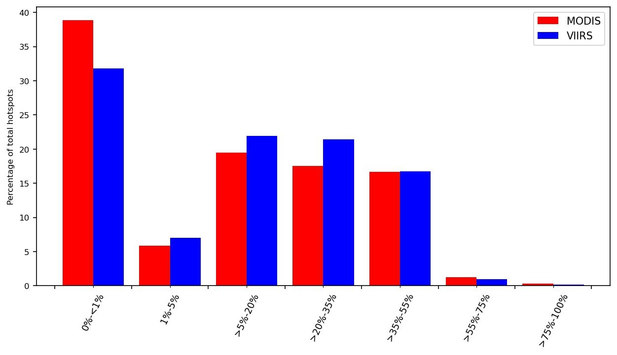
The annual variability in wildfire activity can be illustrated with 3 plots created from different datasets: the Canadian Interagency Forest Fire Centre (CIFFC) reports daily fire activity across Canada; NASA's Fire Information for Resource Management System (FIRMS) distributes fire hotspot products from the Moderate Resolution Imaging Spectroradiometer (MODIS) on the Terra and Aqua satellite, and the Visible Infrared Imaging Radiometer Suite (VIIRS) on the Suomi NPP and NOAA-20 platforms.
The following interactive plots were created with Plotly (https://plotly.com/). The Canadian fire season usually starts in April and ends in September.
I acknowledge the use of data and/or imagery from NASA's Fire Information for Resource Management System (FIRMS) (https://earthdata.nasa.gov/firms), part of NASA's Earth Observing System Data and Information System (EOSDIS).
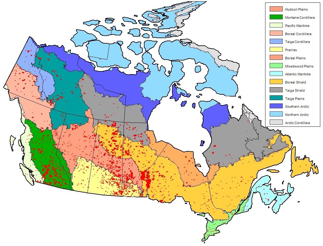
Geographical Distribution of Fire Hotspots across Canadian Ecozones
 |
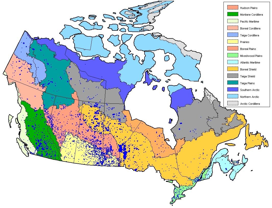 |
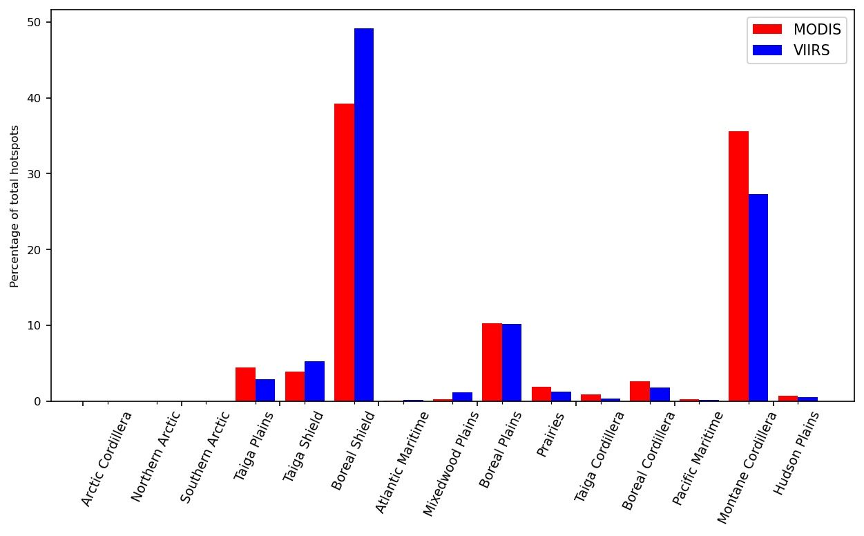
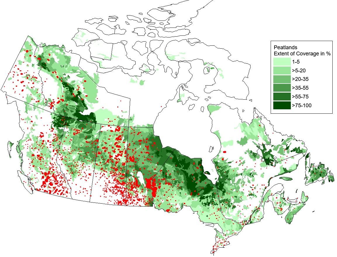
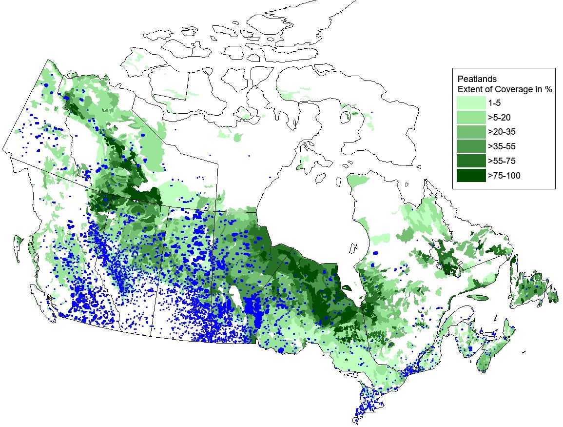
Geographical Distribution of Fire Hotspots across Canadian Peatlands
 |
 |