Fire Danger
Fire danger is a broad term used to characterize a number of factors influencing the fire environment. A fire danger rating system consists of various qualitative and numeric indices used in fire management activities. These indices provide estimates of potential fire danger in an area where meteorological conditions are known.
Fire indices can be calculated at local scale with weather station records. It is then possible to build historical datasets of fire indices as long as reliable weather data are available. Nowadays indices can be routinely computed from weather forecast model outputs. Models fill in gaps between weather stations and allow us to make estimates for remote areas.
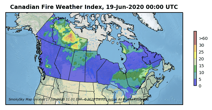
Land management agencies around the world have established various fire danger rating systems to help determine where and when preventive measures should be deployed. The United States Forest Service has developed a comprehensive system called the National Fire Danger Rating System. Fire danger level is usually indicated on Smokey Bear signs on public lands or at agencies' offices. To assess fire danger in the North American boreal forest, the Forest Service in Canada has established the Canadian Wildland Fire Information System.
|
|
|
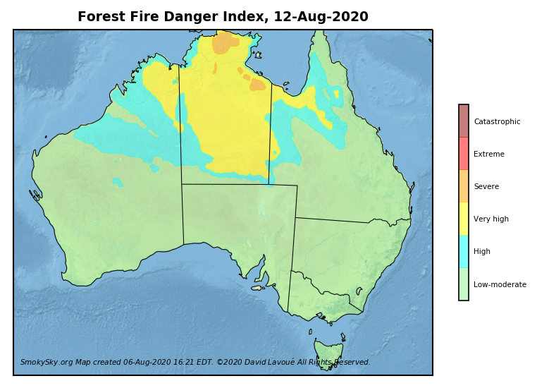
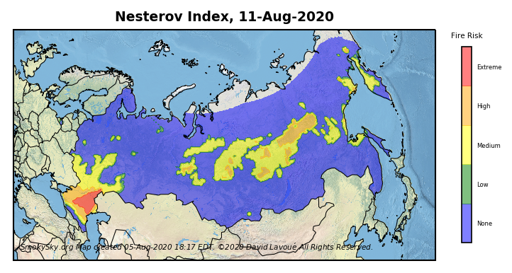
In Australia the McArthur Forest Fire Danger Index gets its name from the CSIRO (Commonwealth Scientific and Industrial Research Organisation) scientist who developed it for Australian forests and grasslands. Russia's official fire danger rating system is the Nesterov Index, which was created at the time of the Soviet Union.
|
|
|
Meteorological Conditions ![]()
![]() Fire Occurrences
Fire Occurrences
Last Modified on 3 May 2021