
Fire Occurrences
Wildland fires may be ignited either by lightning or by humans. The relative proportions of both ignition sources depend on the geographical location. For instance in Southern Europe most fires are of human origin, while in the North American boreal forest the vast majority of fires are ignited by lightning.
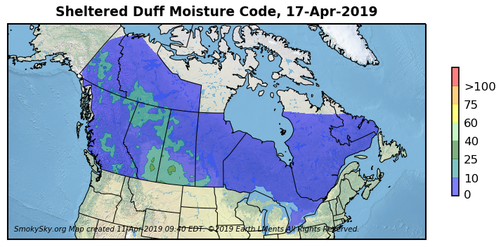
Convective storms are capable of producing numerous cloud-to-ground lightning strikes with very little amounts of rainfall. The Canadian Forest Service has created a specific duff moisture index to assess the susceptibility of forest floors in sheltered areas close to trunks of large trees to ignition by lightning.
|
|
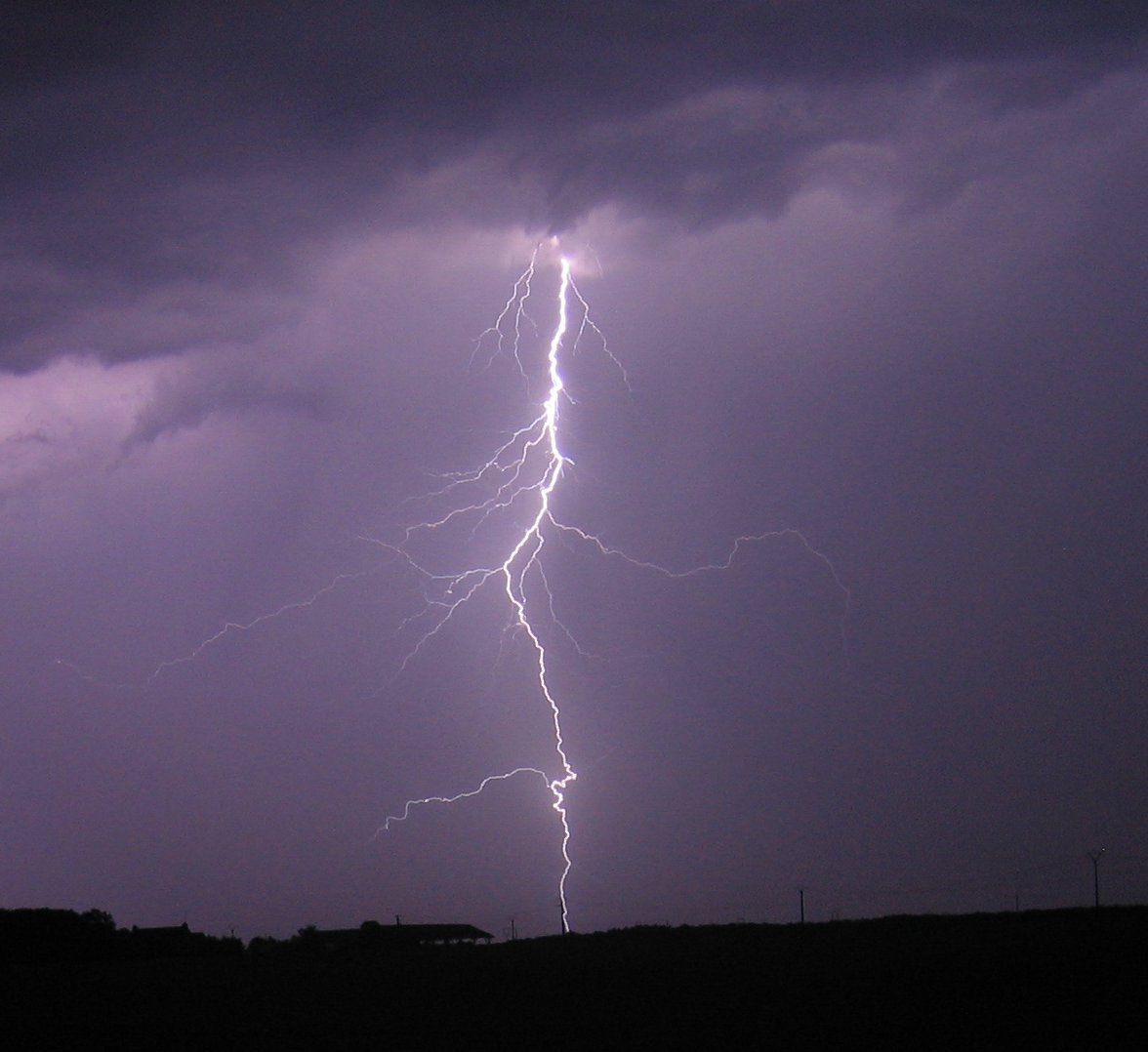
Cloud-to-ground lightning strike. |
Climate model outputs suggest that wildland fire occurrences are expected to significantly increase in the coming decades.
Protection agencies may follow different fire management strategies but are usually able to provide daily information on fire activity in their respective protection zones. Type and format of information made available by agencies can vary considerably. Some give a day by day list of the number of active fires and an estimate of total burned area in their jurisdictions. Others provide online and near real time fire location maps with estimated sizes and burning status of each indivudal fire.
|
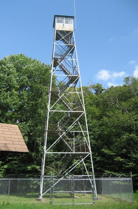
Fire tower in the Allegany State Park, NY, USA |
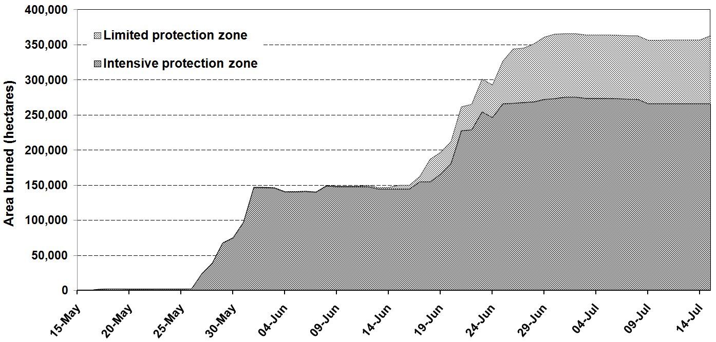
Daily area burned in the Province of Quebec, Canada in 2010 as reported by the Canadian Interagency Forest Fire Centre (CIFFC). |
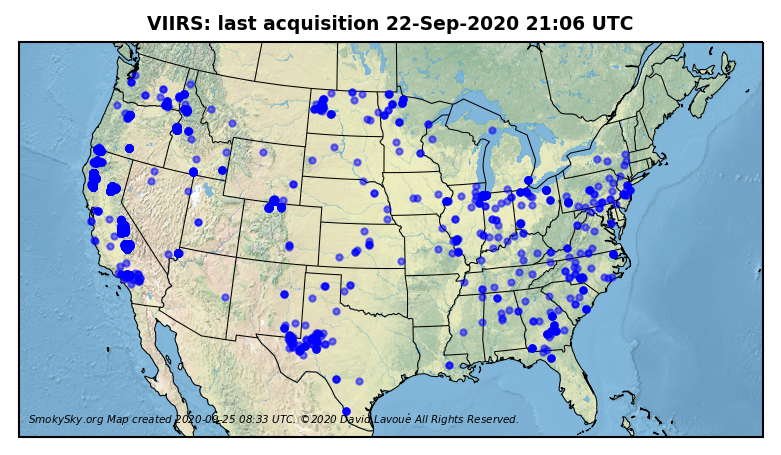
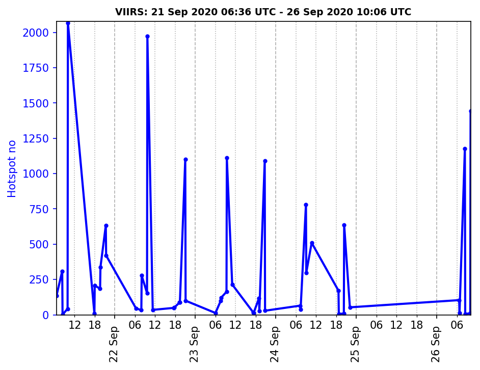
Techniques to retrieve fire activity information from satellite-based observations at various geographical scales have been developed during the 1990s. Space-based infrared sensors are highly useful in detecting, tracking, and assessing hotspots from active vegetation fires, both quantitatively and qualitatively. The development of satellite remote sensing has made possible to detect fires in remote areas, which would otherwise go unnoticed.
|
|
|
Last Modified on 3 May 2021